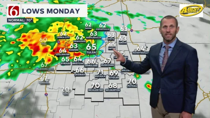
Let’s grab a virtual coffee. You checked the weather app this morning, right? It said “30% chance of rain after 4 PM.” So you left the umbrella in the car, confident in your decision. Fast forward to noon, and you’re watching a biblical deluge from your office window while the sky turns an unsettling shade of green. You’ve just been initiated. Welcome to Tulsa.
Here’s the thing: understanding Tulsa weather isn’t about just reading a forecast. It’s about understanding a personality. A chaotic, beautiful, and sometimes downright terrifying personality. The local joke, “If you don’t like the weather, wait five minutes,” isn’t just a cliché; it’s a survival guide. But why? Why does the sky over Green Country have more mood swings than a teenager on a Tuesday?
I’ve spent years watching these skies, and what fascinates me is the story behind the chaos. It’s not random. It’s a very specific, very powerful confluence of geographic and atmospheric forces. And once you understand that story, the daily weather report starts to make a whole lot more sense. It becomes less of a frustrating lie and more of an educated guess in a high-stakes game.
So, let’s pull back the curtain. This isn’t just about tomorrow’s temperature; this is about the epic drama unfolding 30,000 feet above our heads.
The Geographic Jackpot (or, The Atmospheric Battlefield)
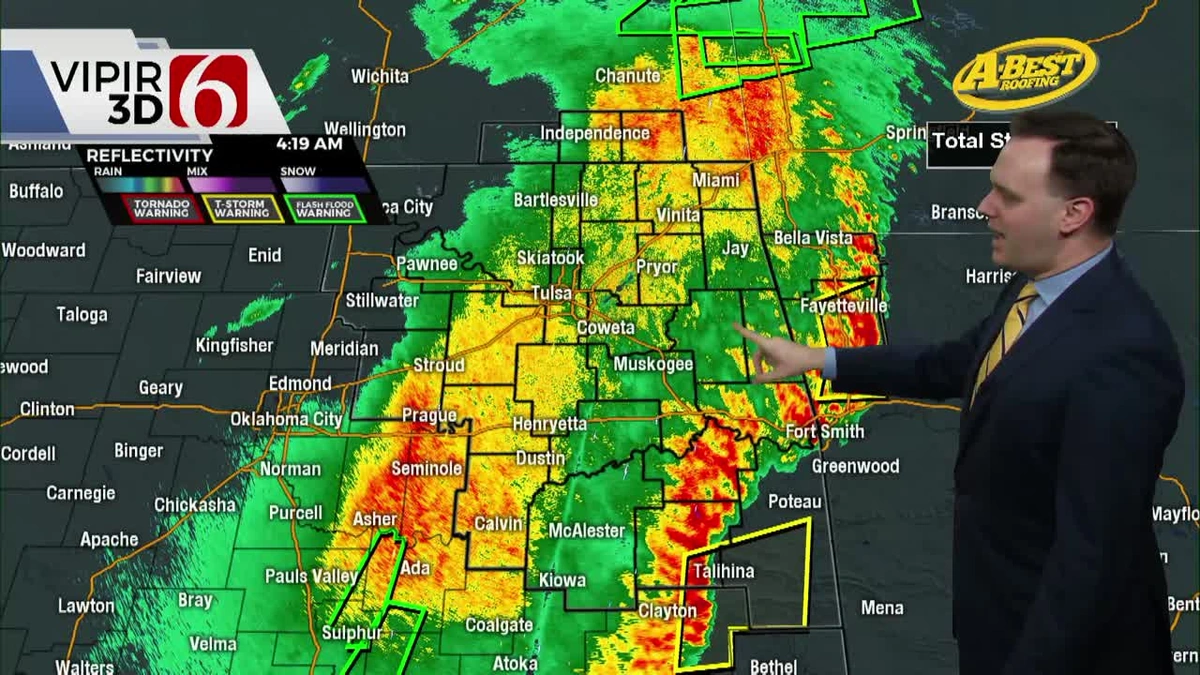
First, you have to appreciate where Tulsa is on a map. We’re not near an ocean. We’re not nestled in a massive mountain range. We’re at a crossroads. An atmospheric intersection where massive, competing air masses slam into each other constantly.
Think of it like this:
- From the South: You have the Gulf of Mexico, relentlessly pumping warm, sticky, moisture-laden air northward. This is the fuel. It’s the gasoline waiting for a match.
- From the West and Southwest: Over the Rocky Mountains and the high deserts of New Mexico, you have incredibly dry, hot air. It’s thin, but it’s potent.
- From the North: And then, you have the cold, dense, arctic air that barrels down from Canada, especially during the spring and fall transition seasons.
Tulsa sits right in the middle of this epic collision zone. It’s a battlefield. Most places get their weather from one or two dominant patterns. We get it from all three, and they’re all fighting for control. This is the fundamental reason for the legendary unpredictability of the Tulsa Oklahoma weather .
Welcome to Tornado Alley | The Secret of the ‘Dry Line’
Okay, now for the main event. The reason northeastern Oklahoma is a global hotspot for photographers, scientists, and storm chasers. It’s the reason for the sirens. Let’s talk about severe weather in Tulsa .
I used to think all big storms were just about hot air meeting cold air. But here, the real star of the show is something far more subtle and violent: the dry line. You’ll hear meteorologists talk about it, but what is it, really?
It’s not a cold front. It’s not a warm front. It’s a moisture boundary.
Imagine that hot, dry air from the desert I mentioned. It’s much denser than the warm, moist air from the Gulf. When that dry line pushes east, it acts like a wedge, aggressively shoving the moist, unstable Gulf air straight up into the atmosphere with explosive force. This rapid upward motion is the trigger for the most powerful thunderstorms on the planet supercells. And supercells are the factories that produce giant hail, destructive winds, and, yes, tornadoes. This is the very engine of Tornado Alley Oklahoma .
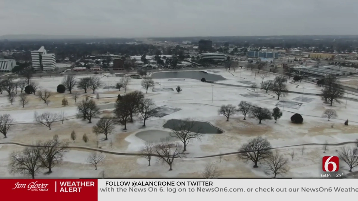
When you see the Tulsa radar light up with those terrifying purple and red splotches in May, you’re often watching the direct result of the dry line doing its violent work. Check out this National Weather Service glossary to get even deeper into the terminology.
A Four-Season Guide to Tulsa’s Atmospheric Moods
While spring gets all the headlines, Tulsa’s weather is a year-round adventure. Every season has its own unique brand of chaos.
- Spring (The Headliner): This is prime time. From March to early June, the clash of air masses is at its most extreme. This is when you get the “green sky” (caused by sunlight scattering through the immense amount of water and hail in a supercell), the tornado sirens, and the daily need to check your local news app. You learn to respect the sky. You can find more info at a place like USA Trending Todays for regional updates.
- Summer (The Steam Room): Once the dry line retreats for the summer, the Gulf of Mexico takes over. Welcome to the “heat dome.” Oppressive humidity and scorching temperatures rule the day. The storms are different, too—less organized supercells and more pop-up “air mass” thunderstorms that seem to appear out of nowhere on a hot afternoon, dumping an inch of rain in 20 minutes and then vanishing.
- Fall (The Encore): Don’t sleep on autumn. As the jet stream begins to dip south again, we often experience a “second season” of severe weather in October and November. It’s usually not as intense as spring, but it’s a sharp reminder that the atmospheric battle is never truly over.
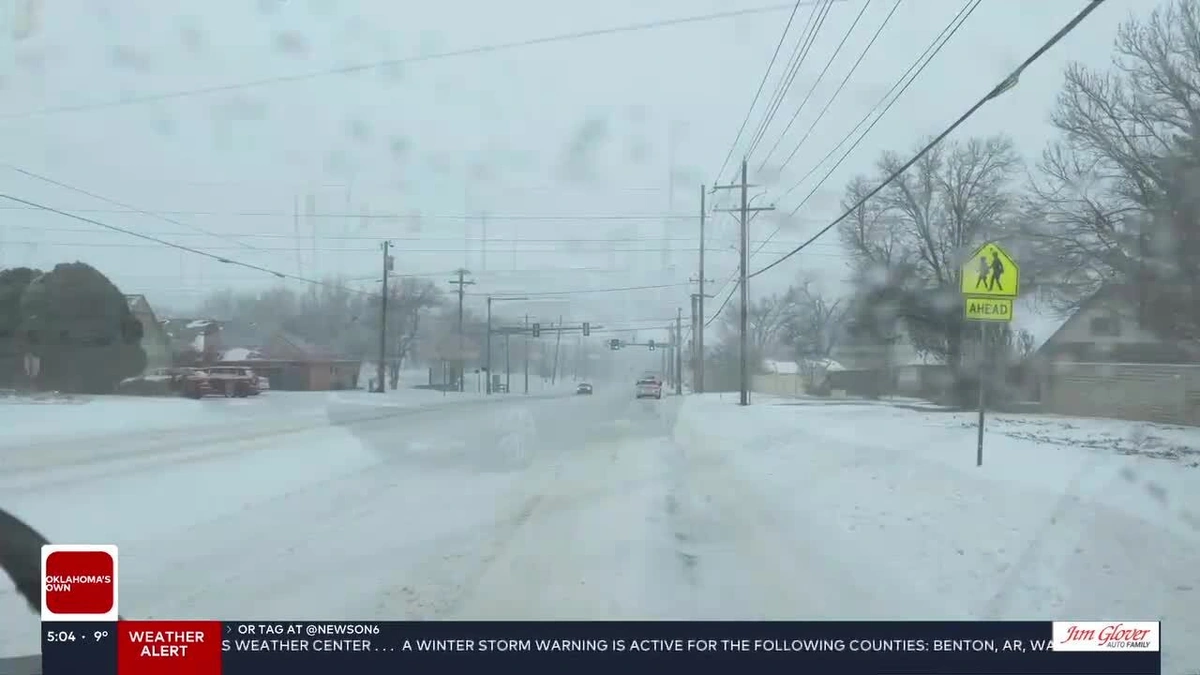
- Winter (The Ice Queen): Snow isn’t our biggest winter threat. It’s ice. Because we’re often hovering right around the freezing mark, we’re prone to freezing rain. This happens when a shallow layer of cold air is trapped at the surface, with warmer air above it. Rain falls, hits the frozen ground, and coats everything in a treacherous, beautiful, and destructive layer of ice.
How to Actually Use the Tulsa Weather Forecast
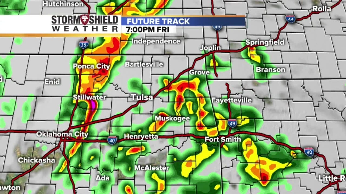
So, if the forecast is so often a suggestion, how do you stay safe and sane? You learn to read between the lines and become your own amateur meteorologist.
- Trust the Trend, Not the Timing: If the Tulsa weather forecast says severe storms are possible in the afternoon, don’t get hung up on whether it says 2 PM or 4 PM. Focus on the “what” (severe storms) and the “when” (afternoon). The atmosphere is too complex for perfect timing.
- Become a Radar Watcher: Your phone’s default weather app is fine, but a dedicated radar app is better. Learn to spot the hook echoes and intense cores of storms. It gives you a real-time picture that no percentage can.
- Have Multiple Ways to Get Warnings: Don’t rely on just one thing. Have a NOAA Weather Radio, enable emergency alerts on your phone, and have a trusted local news app. The outdoor sirens are designed to be heard *outdoors*. You may not hear them inside during a loud storm.
- Know Your County: Tornado warnings are issued by county. When you hear a warning for Tulsa County, you need to know if the storm is tracking toward your specific location within it.
Living here means having a healthy respect for the sky. It’s a source of conversation, a force of nature that connects the entire community, and a constant, powerful reminder that we’re all just along for the ride. And what a wild ride it is. For more context on major events, you might look at a site like USA Trending Todays .
Frequently Asked Questions About Tulsa Weather
What’s the difference between a Tornado Watch and a Tornado Warning?
This is the most important one! A Tornado Watch means conditions are favorable for tornadoes to develop in the area. It’s time to be prepared and stay aware. A Tornado Warning means a tornado has been sighted or indicated by weather radar. This means danger is imminent, and you need to take shelter immediately.
What does the “green sky” actually mean before a storm?
That eerie green or teal color is often a sign of a very powerful thunderstorm. The theory is that the unique blue light from the massive amount of water/ice particles in a supercell cloud is illuminated by the reddish/yellow light of the setting sun, creating a green hue. When you see it, take it seriously.
Why is the humidity so bad in the summer?
It’s all about our proximity to the Gulf of Mexico. That southerly wind continuously pumps moisture-rich air into the region. With high temperatures, that moisture gets trapped, creating the oppressive humidity we all know and… well, that we know.
Is it true Tulsa has a “force field” that splits storms?
This is a popular local myth! People notice big storms seeming to split and go around the city core. In reality, it’s often a combination of perspective and coincidence. Sometimes, the urban “heat island” effect can slightly alter a storm’s path, but there’s no magical protective bubble. Storms can and do hit the city directly.
What is the most dangerous weather threat in Tulsa?
While tornadoes get the most attention, other threats can be just as dangerous. Flash flooding from heavy rain is a serious risk, as are straight-line winds from thunderstorms, which can cause widespread damage. In the summer, heat and humidity are significant health risks.

